www.johntyman.com/peru/19.html
 |
CULTURES IN CONTEXT PERU The Incas and Prehistoric Cultures IV: INCA CULTURE 4.10: Machu Picchu |
199. Machu Picchu is unique among major Inca historic sites in that it was not despoiled by the conquistadors, because its location was a closely guarded secret, although it was located only about 80 kms from Cuzco. It would in any case have been difficult to attack on horseback, being positioned on the summit of a steep-sided mountain ridge and surrounded by dense rainforest. |
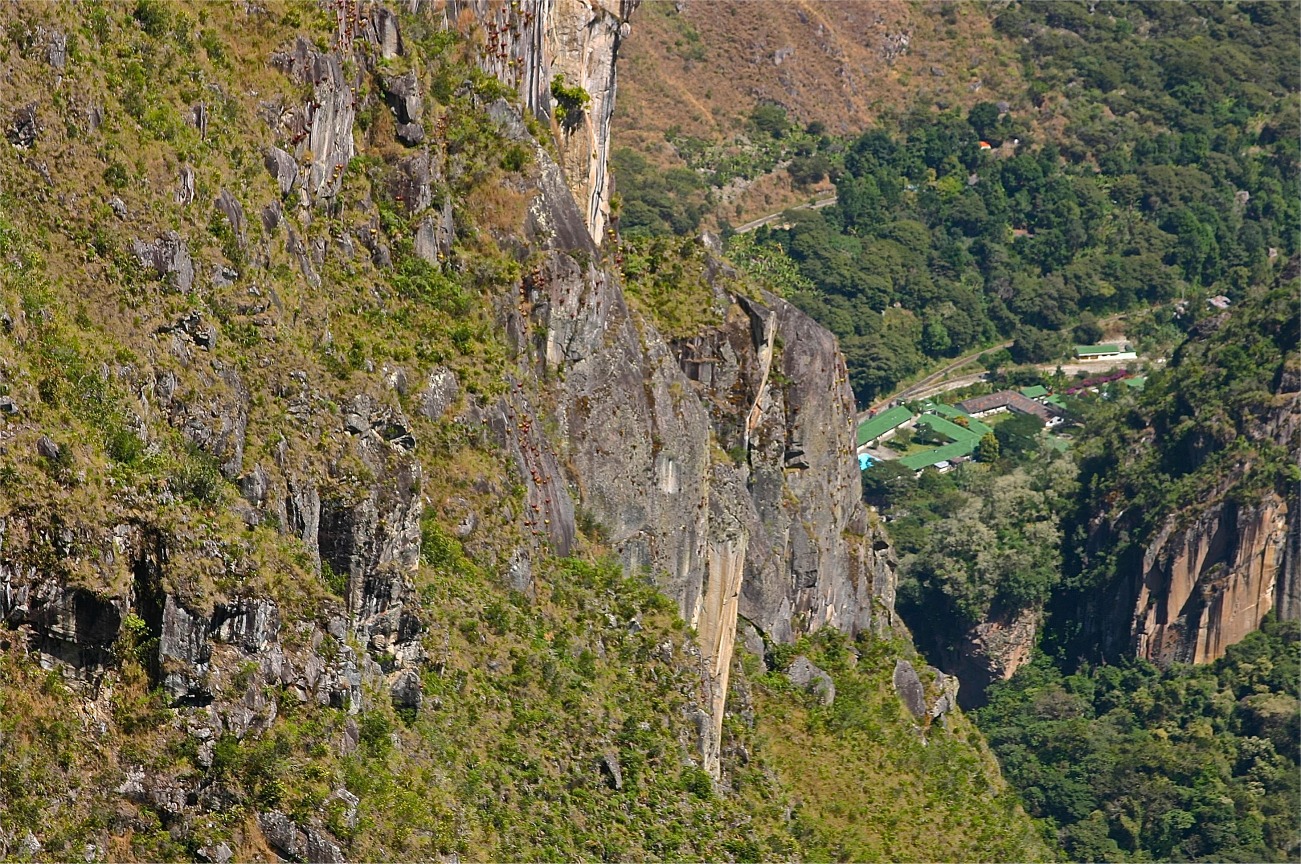
200. It was built around 1450 but abandoned 80 years later at the time of the Spanish invasion of Peru. It was commissioned by the Inca Pachakuti in a defensive position above a loop in the Urubamba River which surrounds the site on three sides; and where the land dropped almost vertically for 450 metres to the river at its base. |
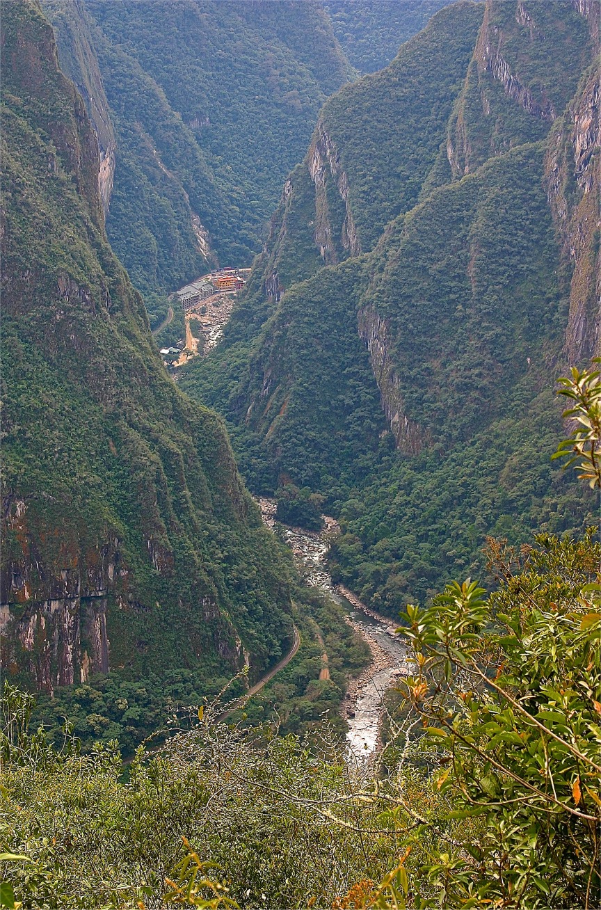
201. Approaches to the site were also kept secret. The Inca army is believed to have crossed the river using a grass-rope bridge over a gorge nearby at Pongo de Mainique. Another Inca bridge, this one made of tree trunks, was built west of Machu Picchu, at a point where the gorge was particularly narrow. However, nothing remains of either bridge today. |
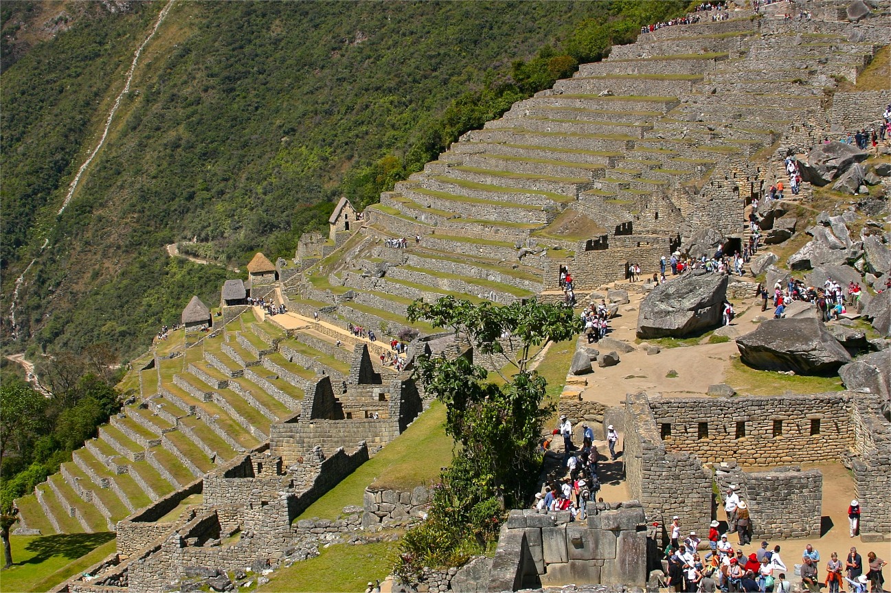
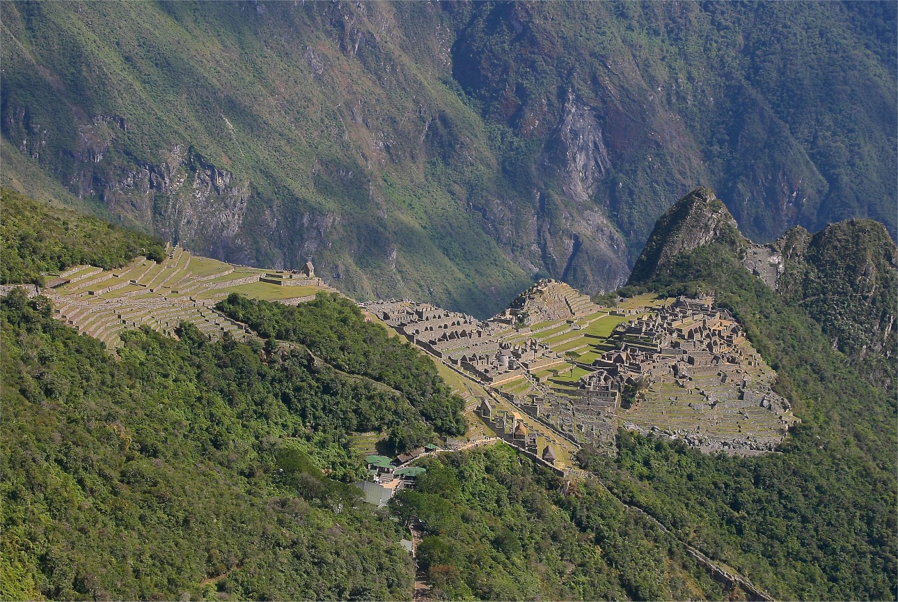
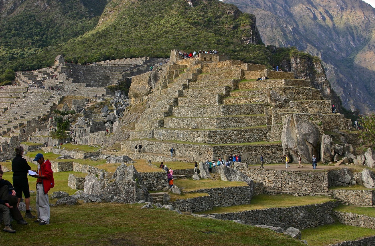
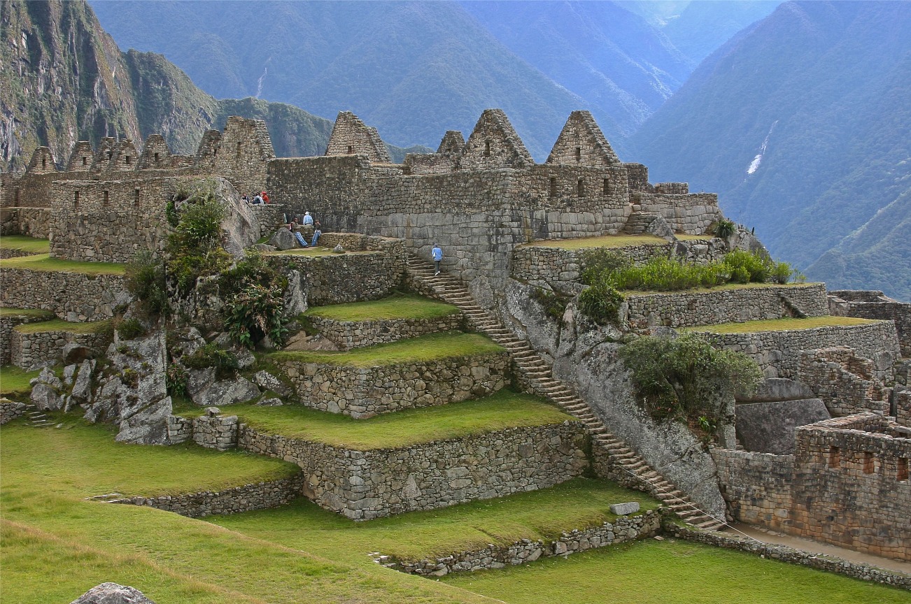
202. Considered a royal estate to which only Inca nobles, priests, priestesses and chosen women had access, it was divided into two sectors, with a terraced agricultural sector on the south, and a citadel on the north with temples, plazas, palaces, and 200 houses. (View from citadel.) |
203. Over the centuries the surrounding jungle overgrew the site, and few people outside the immediate area knew of its existence. The ruins were covered with dense vegetation except for the agricultural terraces and clearings used by local farmers as vegetable gardens. |
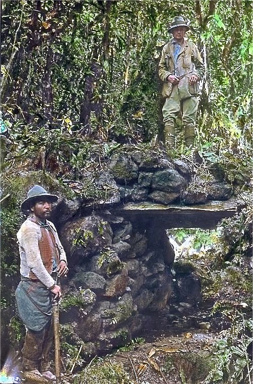
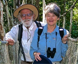
204. The citys location remained a secret after it was abandoned, to avoid pillage by the conquistadors who had despoiled so many other sites. Its existence was unknown to the outside world till it was discovered by Hiram Bingham in 1911. Using local labour, he removed the forest to reveal what is now the focus of Perus tourist industry. (Bingham with a guide) |
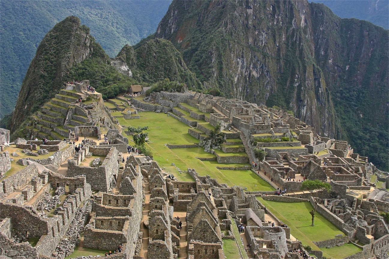
205. Many of the buildings here today have been rebuilt to give tourists a better idea of how the city looked originally with the exception of a large sculptured rock in the central plaza which was moved to a different location in the 1980s to provide a helicopter landing zone so Perus president could fly in on a visit! |

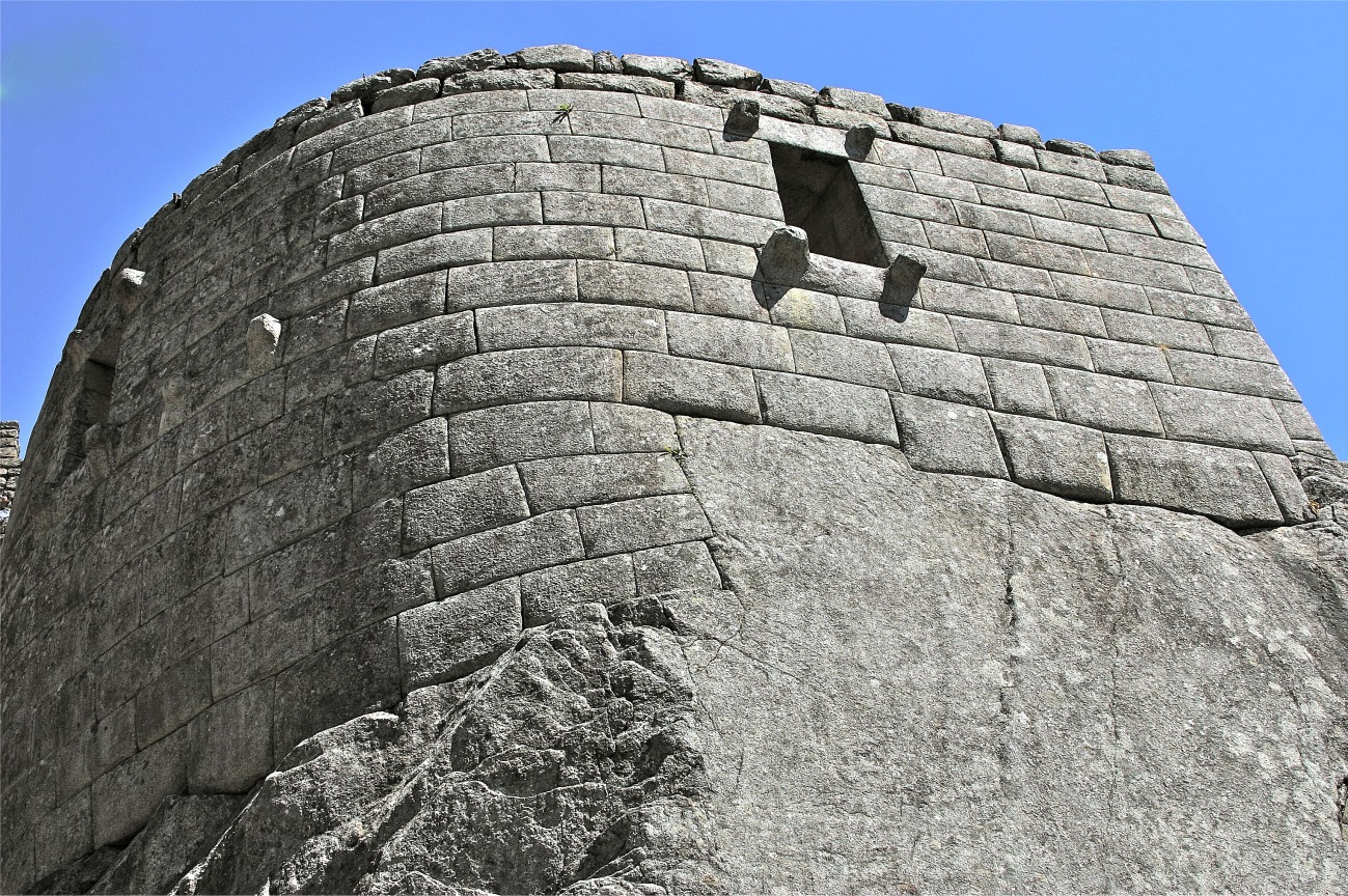
206. The site on which Machu Picchu was built provided particular challenges that the Incas solved with local materials. One issue was seismic activity due to two fault lines here. As in much of Peru, this made mortar and similar building techniques next to useless. Instead, the Incas mined stones from the quarry at the site, lined them up and shaped them to fit together perfectly. |
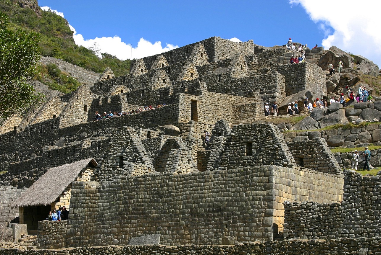
207. Other stabilising features as usual included trapezoidal doorways and windows, outside corners which were rounded; and inside corners inclined slightly inwards. Outside corners were often tied together by "L"-shaped blocks; and many of the blocks used for the walls were offset slightly from row to row, rather than rising straight from bottom to top. |
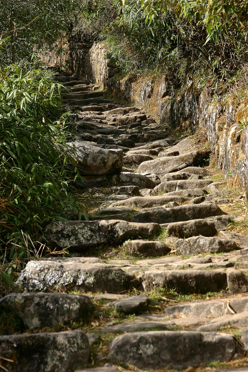
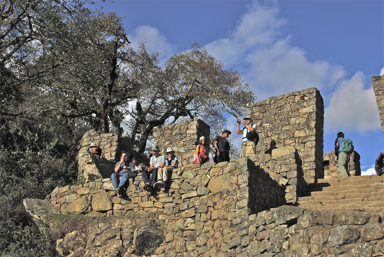
208. Machu Picchu was linked to Cuzco by a well-built road, which allowed for speedy communications between the two cities (and is now popular with tourists). |
209. The road leads to the Sun Gate Intipunku 300 metres above the city. It served as a guardhouse before the city was abandoned. |
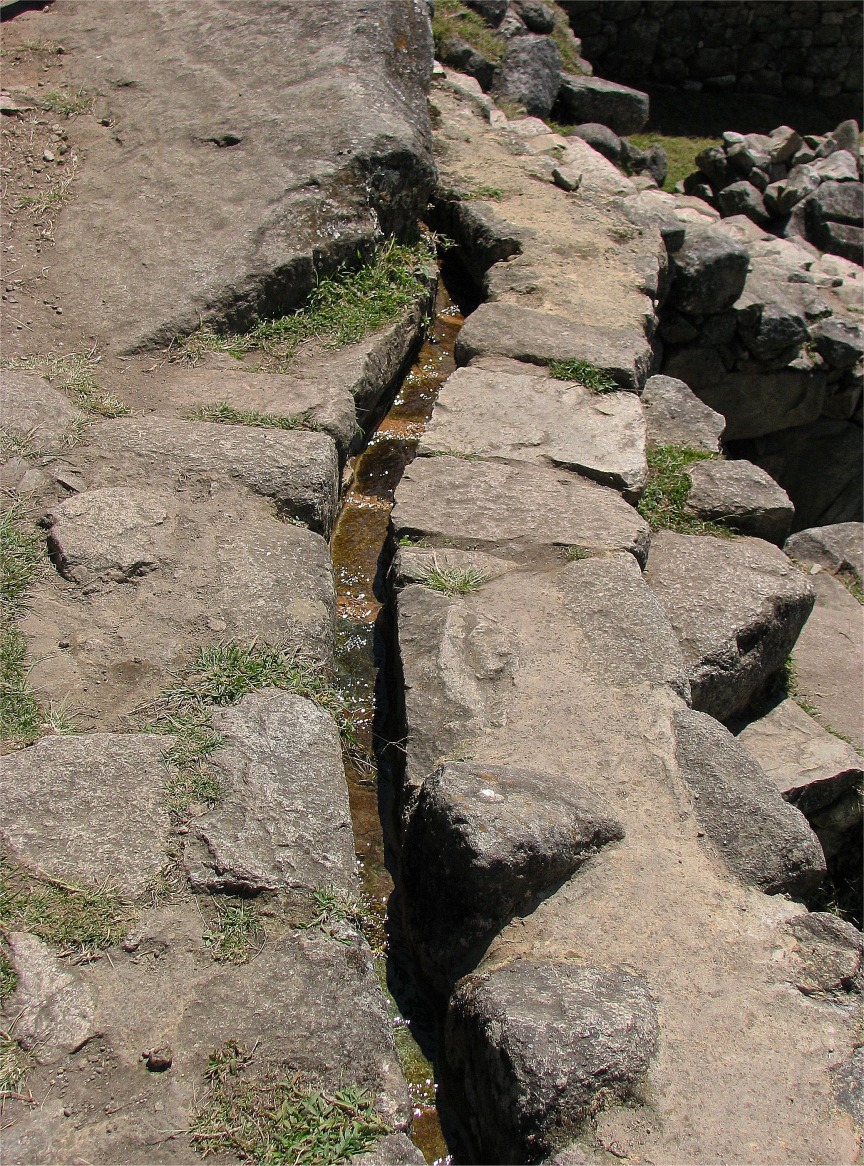
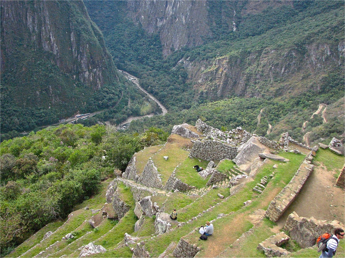
210. The road ran parallel to a man-made stream which carried water from springs higher up, and distributed this throughout the city by a host of smaller channels. The channels also helped prevent erosion and flooding, as did the terraces. |
211. With mild temperatures and an annual rainfall of 1800 mm there was little need for irrigation. The terraces were farmed certainly, but their most critical role was to control runoff and prevent landslides. They were not perfect, however, and there were landslides even during the construction phase. You can still see where the terraces were shifted by landslides and then stabilised by the Incas as they continued to build. |
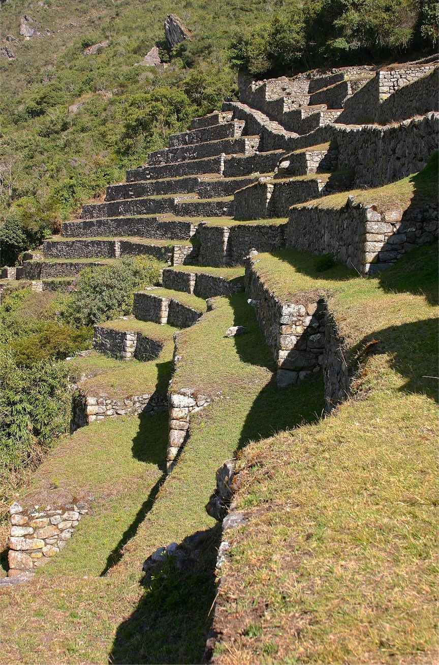
212. As usual the terraces were built in layers, with a bottom layer of larger stones covered by loose gravel, then a layer of mixed sand and gravel packed together, with topsoil covering all of that. The topsoil was probably brought from the valley floor below because it was much better for cropping than that higher up the mountain. |
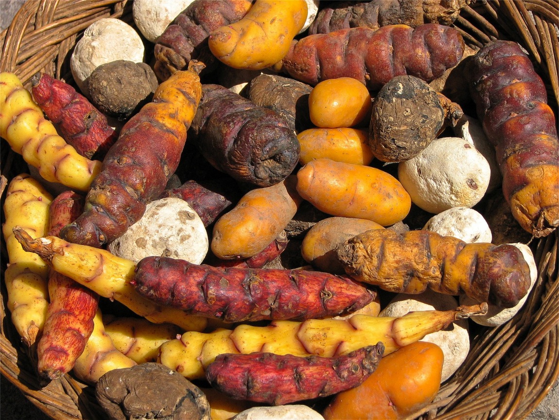
213. The total area of the agricultural terraces at Machu Picchu is only 5 hectares. Recent studies of the soil have established that corn and potatoes were grown, but the total harvest over this small area would not have been enough to support the 750+ people living at Machu Picchu. Instead it was discovered that most of their food was imported from the surrounding valleys and farther afield. |
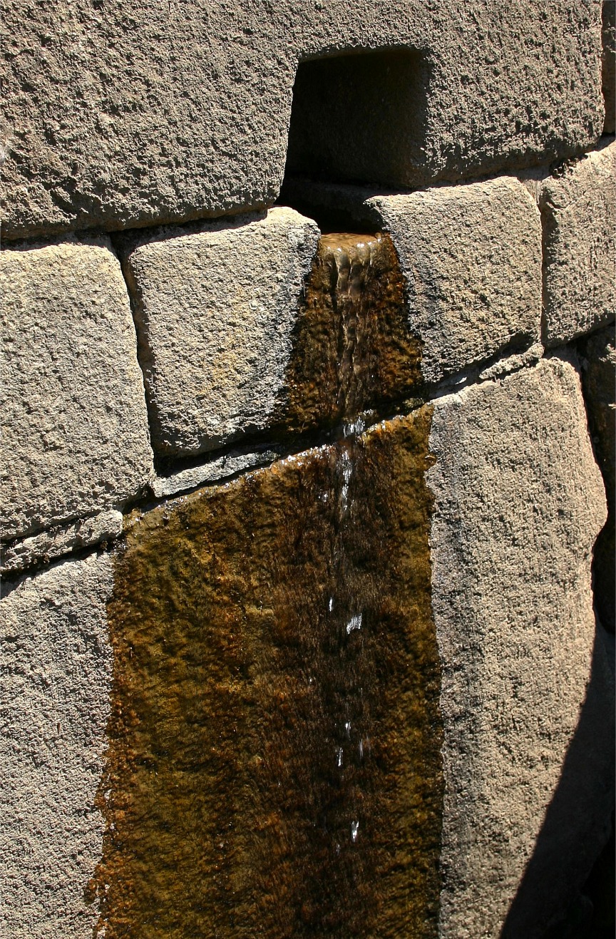
214. The different sectors of the citadel opposite the terraces were connected by a series of streets and pathways, in some cases carved out of the rock, and were equipped with a hydraulic system of pacchas or fountains. |
215. Stone stairways provided access to the different levels across the site. The eastern section of the citadel was probably residential. The western section, on the higher side of the square, was for religious and ceremonial purposes, and contained the Temple of the Sun. |
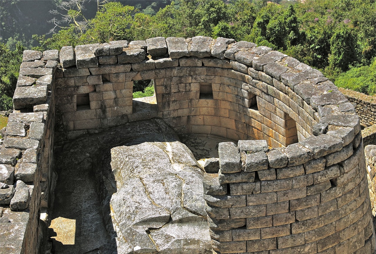
216 The tower known as Torreon was arguably the most important building, and was also a rare example of curved Inca architecture. It was positioned within the Temple of the Sun at its highest point to be closest to the sun. This was where the most important events were held including astrological observations to establish the Inca calendar, sacred rituals and religious sacrifices. |
217. The Torreon had two trapezoidal windows, through which the sun was observed at solstices. The winter solstice on June 21st marked the start of winter and in Inca times was celebrated as Inti Raymi or the Festival of the Sun. At dawn on that day when the very first sunlight rises over the distant mountains, it shines through one of the two windows of the Temple of the Sun and illuminates the ceremonial stone within. The second window was for the suns rays at the summer solstice. |
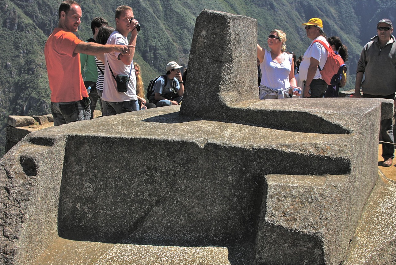
218. The intihuatana, or Hitching Post of the Sun, which lay inside the Torreon, was an altar where the ruler, The Son of the Sun, prayed to the sun. It points directly to the sun at the winter solstice, and was used in combination with the windows to establish the hours of the day and the months of the year. |
219. At the base of the Sun Temple there are the two round structures which were also of astronomical significance. Like the Mayans, the Incas were keen observers of the night sky. They filled these stone-cut depressions with water to produce mirror images used in observations of the stars. |
220. The Condor Stone in the Temple of the Condor was also carved from the bedrock. Its shaped like the head and neck feathers of the condor, a raptor and the largest flying bird in the world. This was a place of sacrifice, an altar where blood was shed. |
![]()
![]()
Text and photos by John Tyman
Intended for Educational Use Only.
Contact Dr. John Tyman at johntyman2@gmail.com
for information regarding public or commercial
use.
![]()
www.hillmanweb.com
Photo processing, Web page layout, formatting
and hosting by
William
Hillman ~ Brandon, Manitoba ~ Canada
