|
John Tyman's Cultures in Context Series EGYPT and the SAHARA www.johntyman.com/sahara |
|
1.1 Landforms 001-020 |
| , |
|
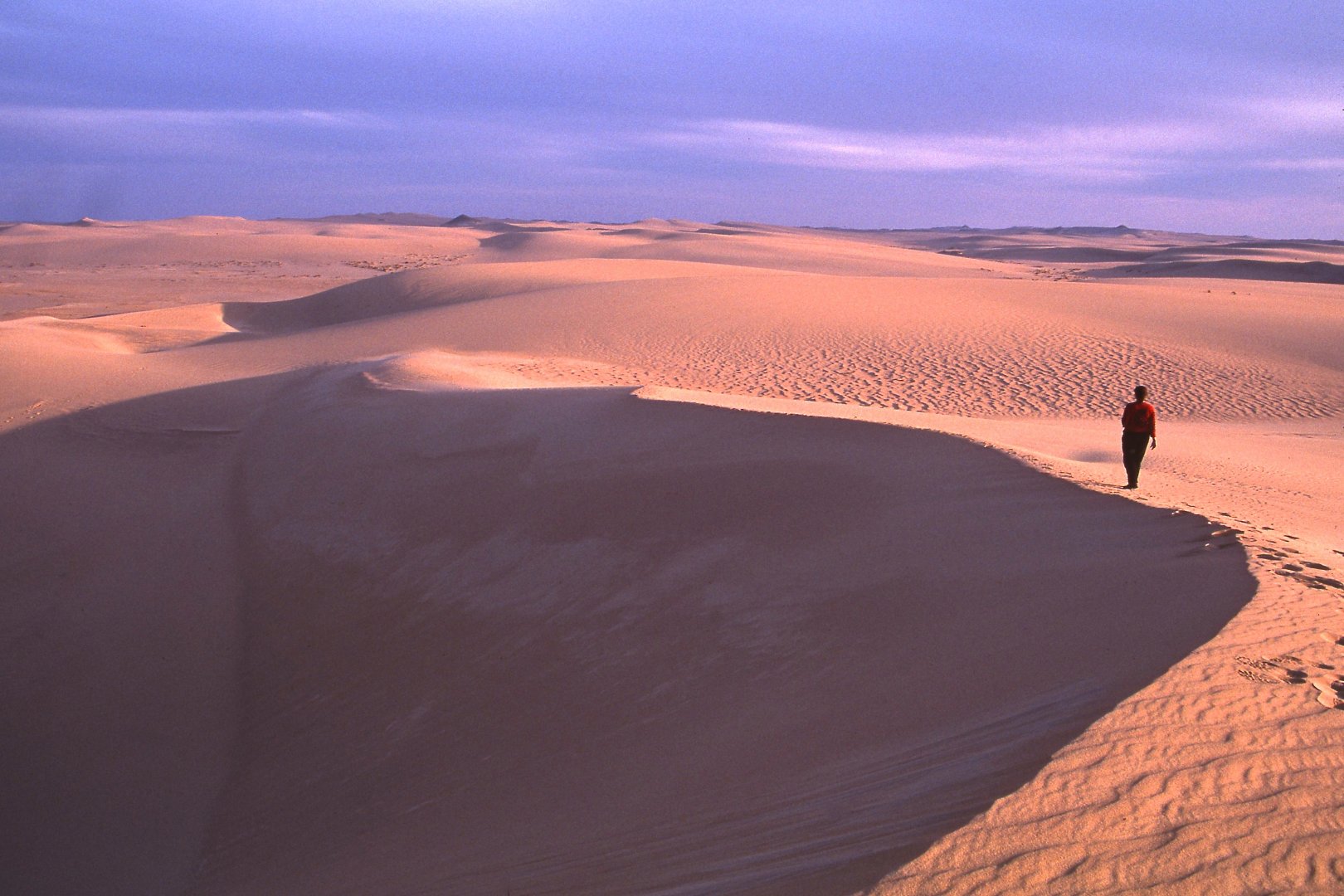
John Tyman's Cultures in Context Series EGYPT and the SAHARA www.johntyman.com/sahara |
|
1.1 Landforms 001-020 |
| , |
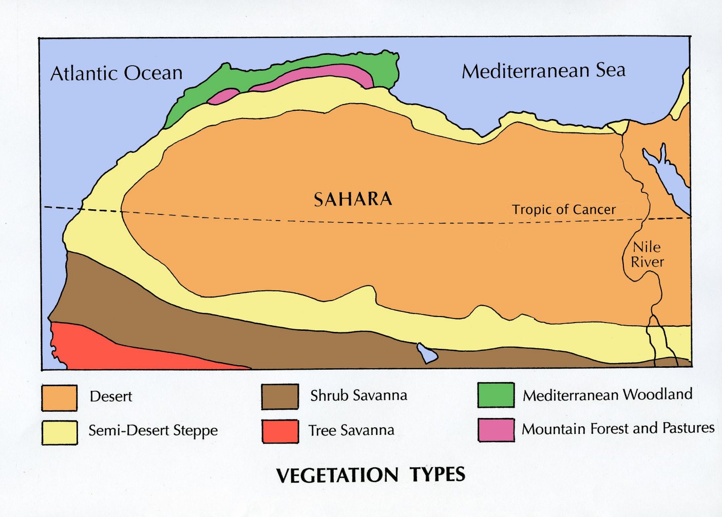 |
| 001. The Sahara is the world's largest desert, extending 4,000 kms from the Atlantic Ocean to the Red Sea, and from the Mediterranean Sea southwards to merge with the tropical savannas of West Africa. With an area of almost 10 million square kilometres it covers almost a third of the African continent! |
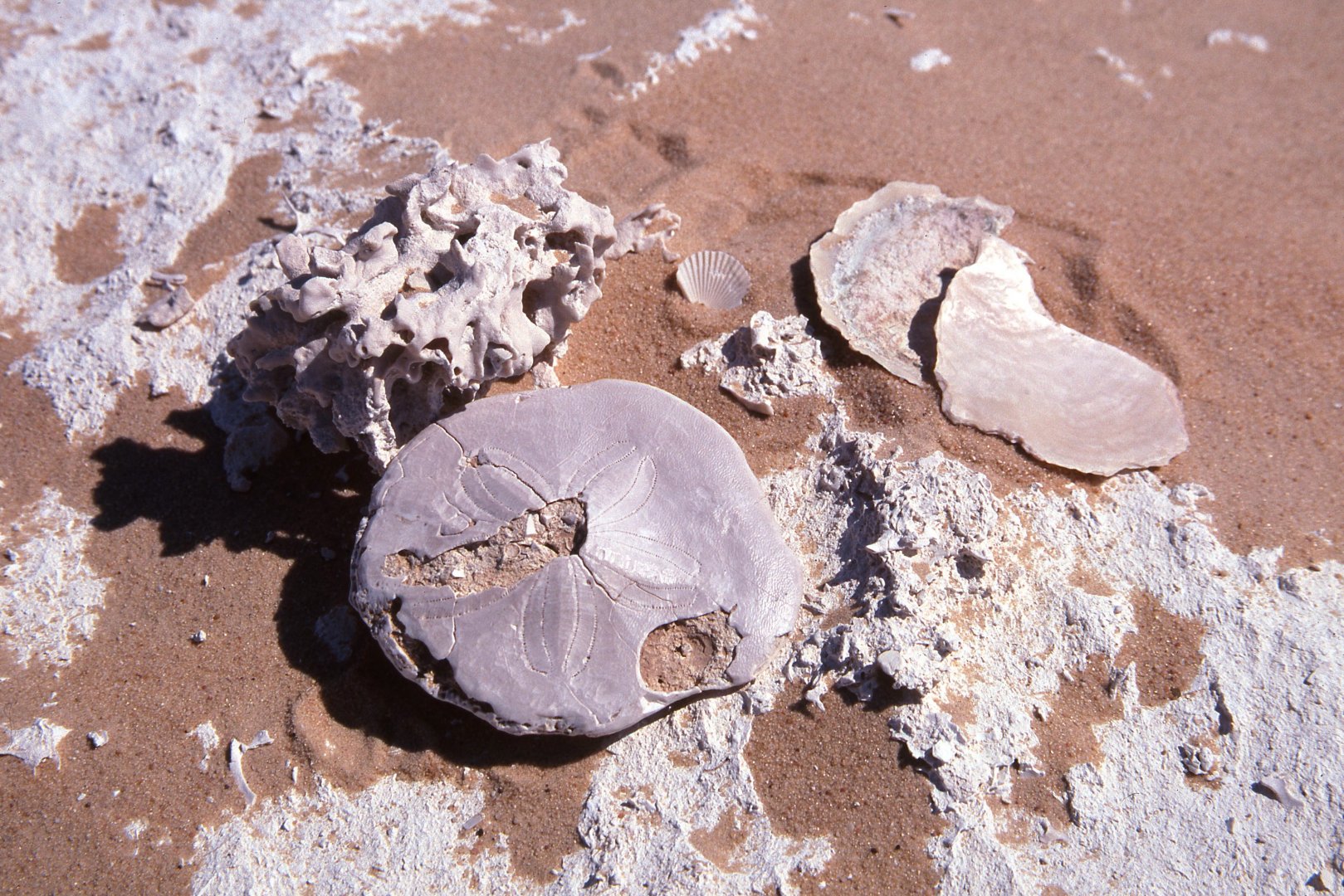 |
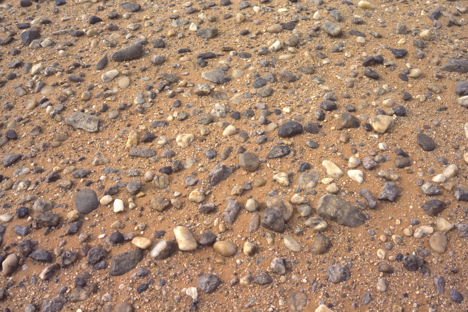
| 002. This region has not always been arid. In places the surface of todays desert is littered with fossils, which demonstrate that at different stages in geological time the area was covered by sea. (Fossil bed near Bir Wahed in the Libyan Sand Sea) |
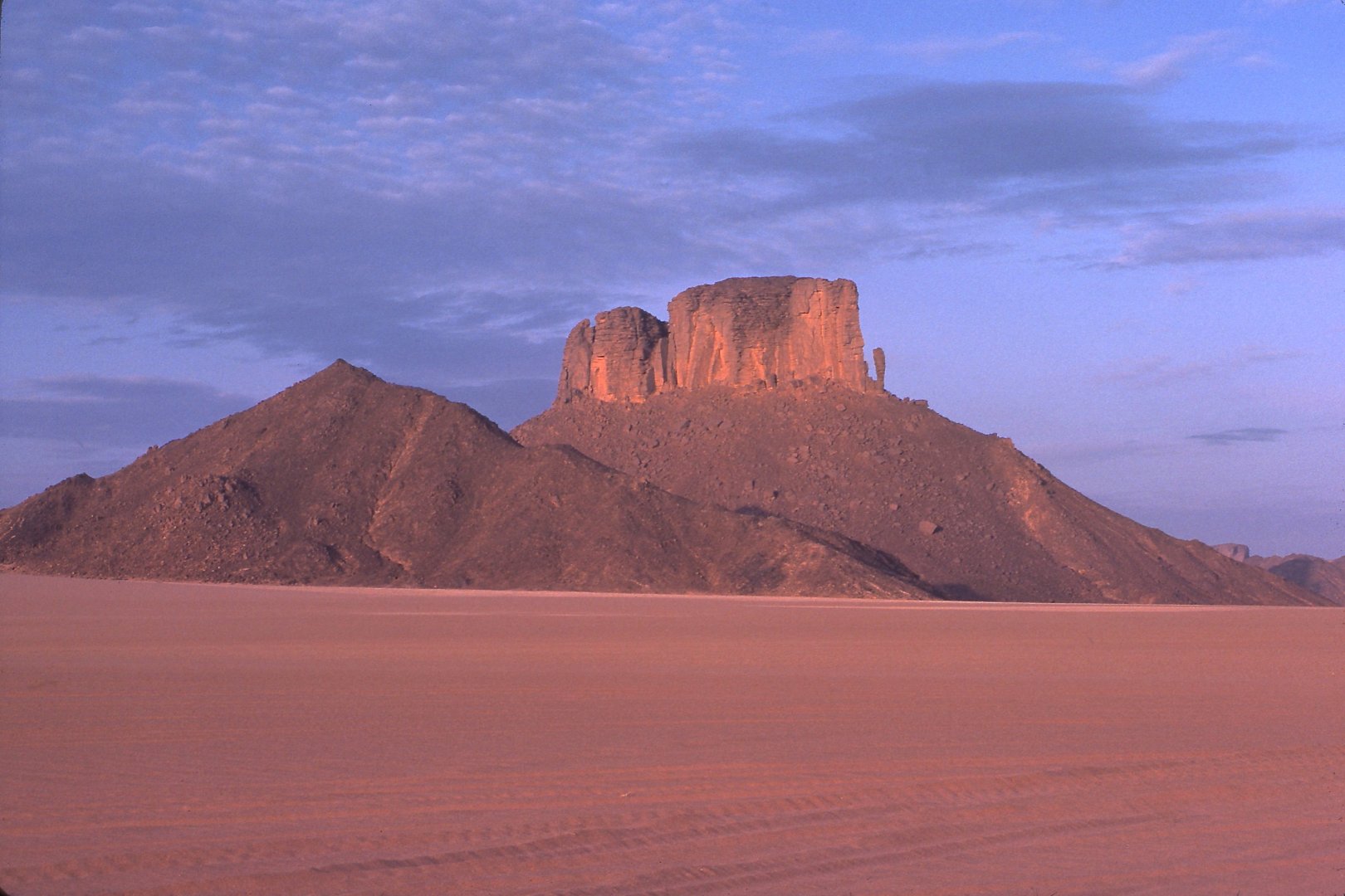 |
| 003. Its initial desiccation was caused by changes in atmospheric circulation in late Cainozoic time (roughly 3 million years ago), and by plate tectonics -- notably the movement of the northern portion of the African plate from wet equatorial latitudes into the dry tropics. (Part of the Erg dAdmer near Djanet) |
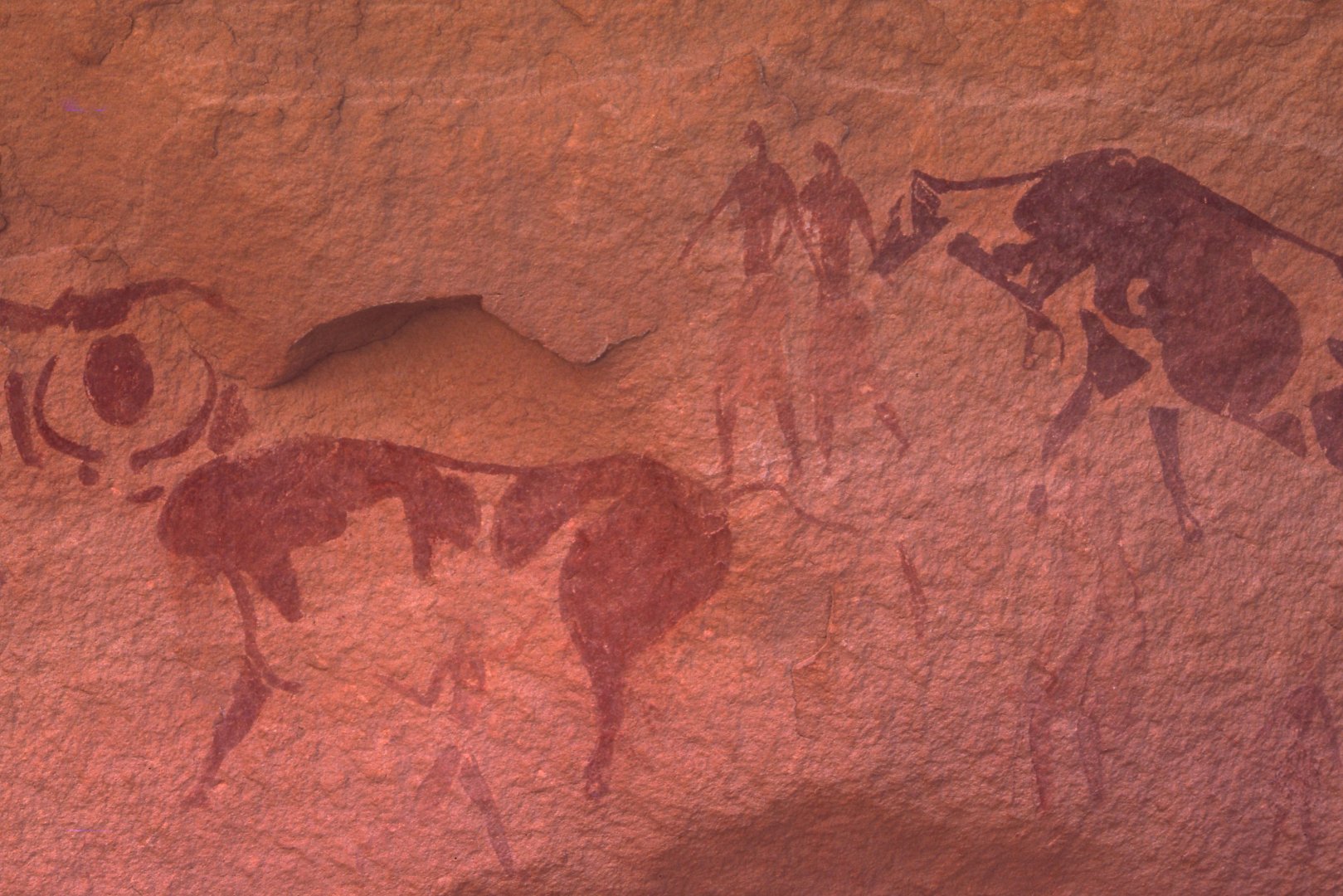 |
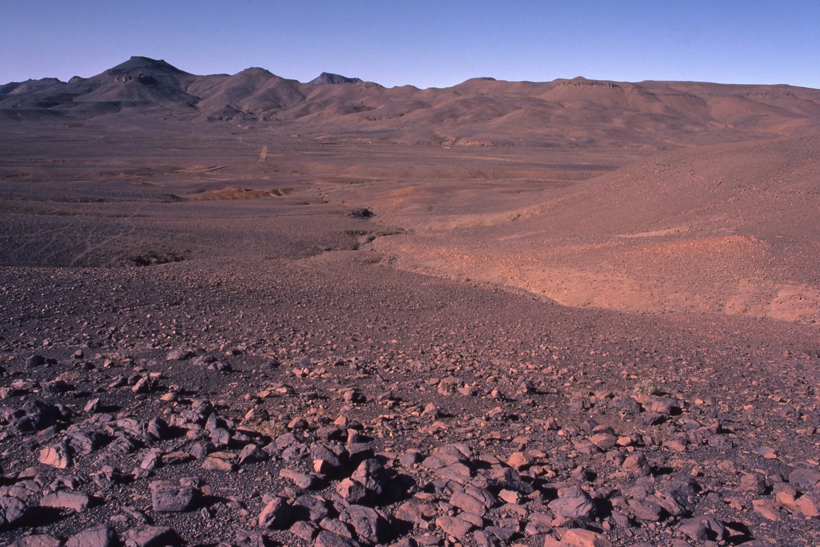
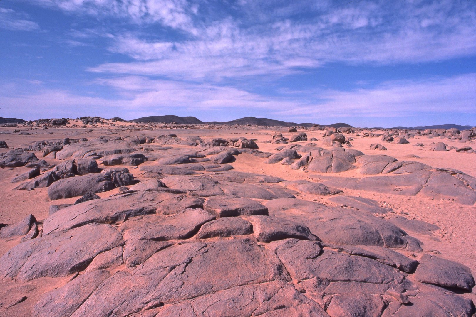
| 004. Its progressive desiccation thereafter was caused in part by prehistoric peoples who contributed to the destruction of the local plant cover. It is a process that continues to this day because of overgrazing and the ploughing of lands ill-suited to cultivation. So the desert continues to grow in size. (Cave painting of prehistoric herding in the Tassili-n-Ajjer) |
 |
| 005. The word "Sahara" is derived from the Arabic word sahra, which indicates an "empty area" or "wilderness". It is one of the most hostile environments on earth, where all life -- plant, animal and human -- must adapt if it is to survive. (The Erg dAdmer near Djanet) |
 |
| 006. There are deserts in Australia, too, but nowhere where you could you climb on to the roof of a 4WD, look around you and see no vegetation at all. In the Sahara, though, you can drive for days and not see a single plant! (South of In Amenas) |
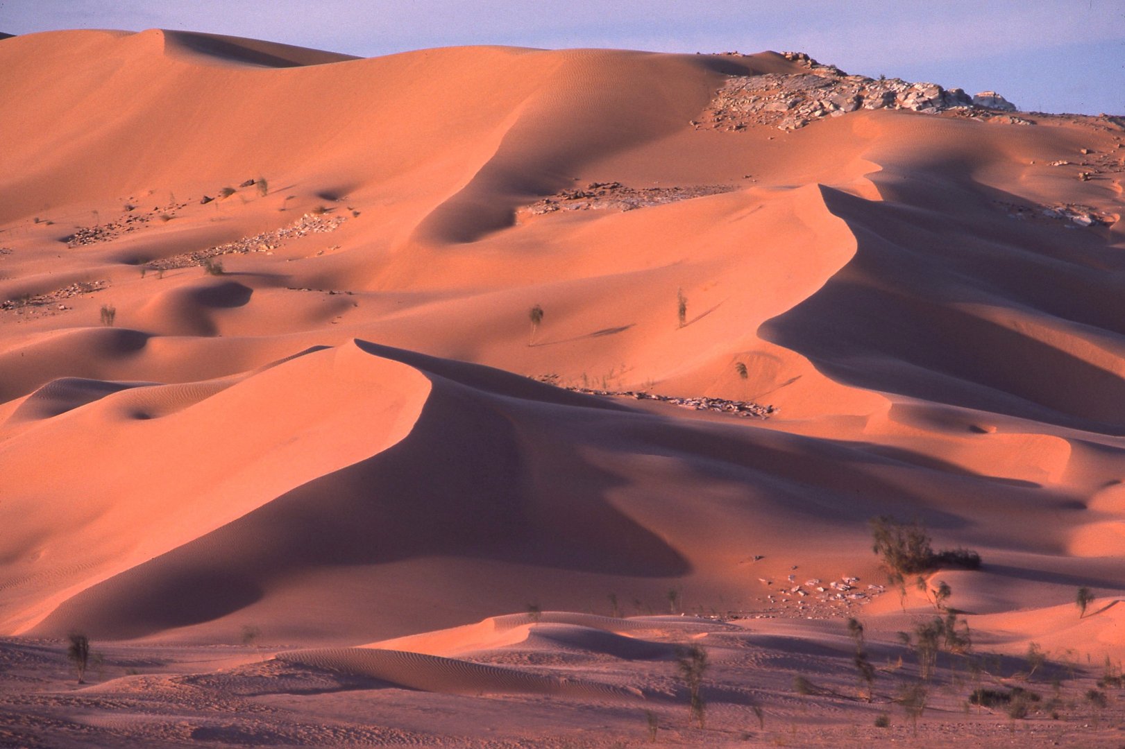 |
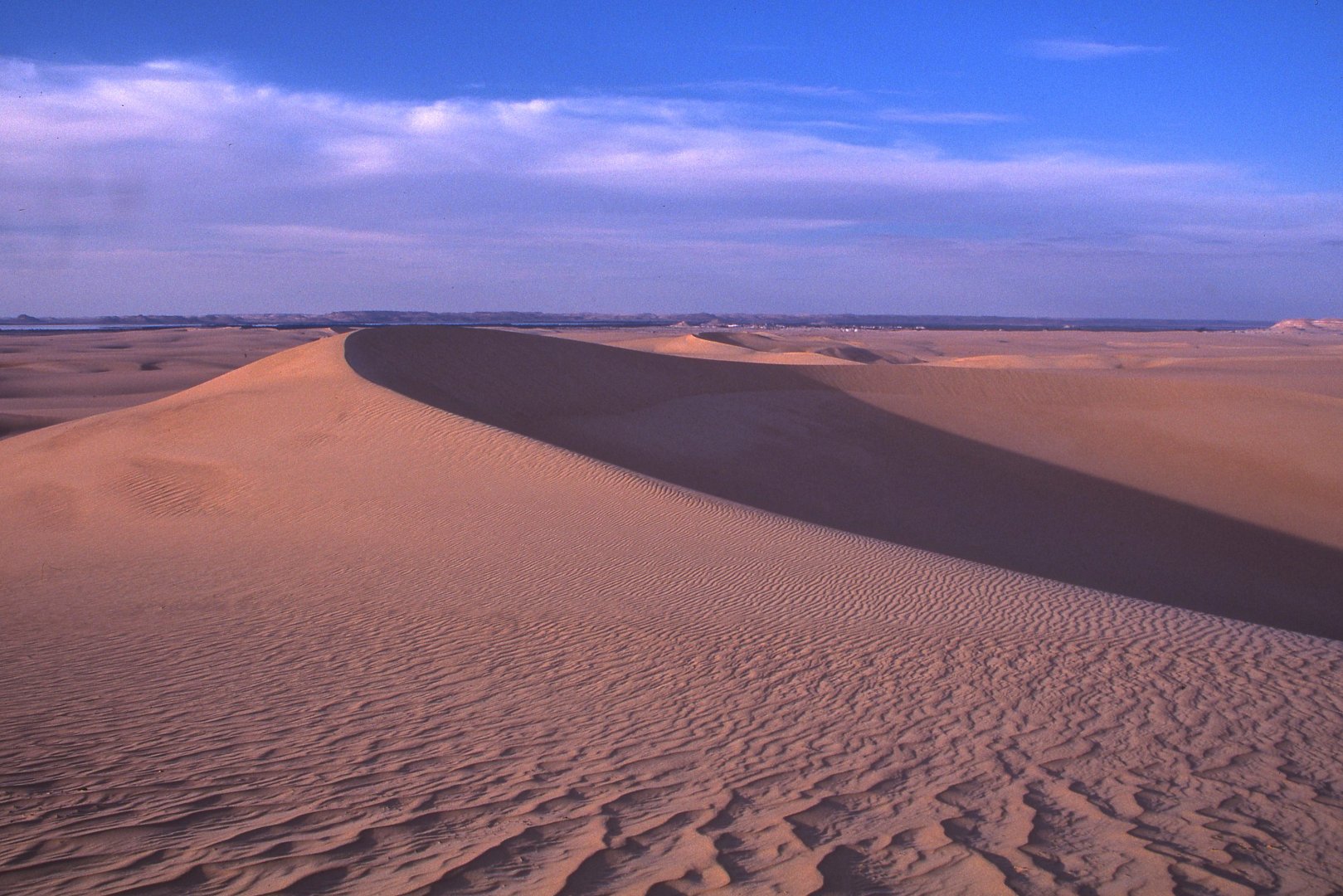
| 007. When they think of the Sahara most people imagine an ocean of large sand dunes. However, sand seas (or ergs) cover only a sixth of its area. The sand itself is driven by the wind and can assume several different forms. (Grand Erg Occidental near El Golea) |
 |
| 008. Barchans like this form where there is plenty of sand and winds that blow consistently from one direction. In plan they are crescent shaped, with arms pointing downwind in the direction of their advance. (Libyan Sand Sea near Bir Wahed) |
 |
| 009. They have a steep leeward slip face and a gentler windward slope. Some appear to be stationary but others are definitely moving. At In Salah they are advancing by almost half a metre annually. (Libyan Sand Sea near Bir Wahed) |
 |
| 010. Where there is less sand it may be scraped into long narrow dune ridges parallel to the direction of the prevailing wind. They are known as seif dunes, after the Arabic word for a sword. (Grand Erg Occidental near El Golea) |
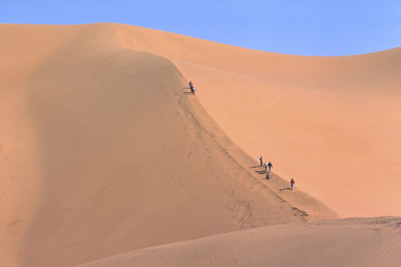 |
| 011. Pyramid or star-shaped dunes are characteristic of areas where winds change direction with the season; and they can be hundreds of metres in height. (South of In Amenas) |
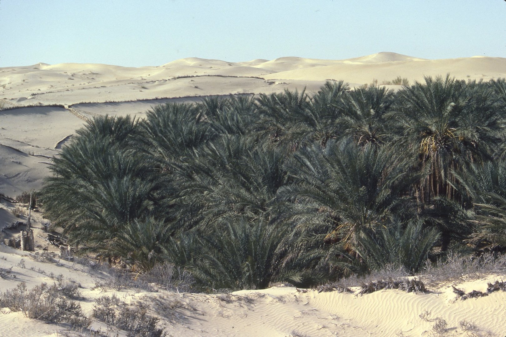 |
| 012. Invasion by moving dunes threatens many agricultural areas. The commonest technique used to stem their advance is to build fences from the branches of date palms pushed into the ground. It works for a while, but they will be over-run eventually and a new battle line will be drawn closer to the settlement. (Oasis in Grand Erg Oriental near El Oued ringed by fences) |
 |
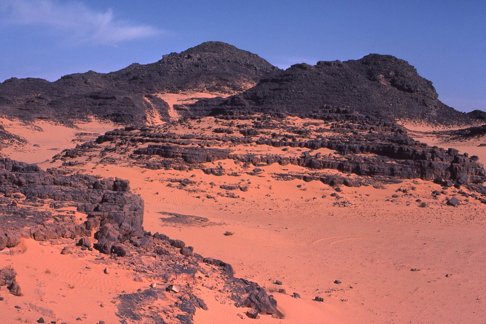
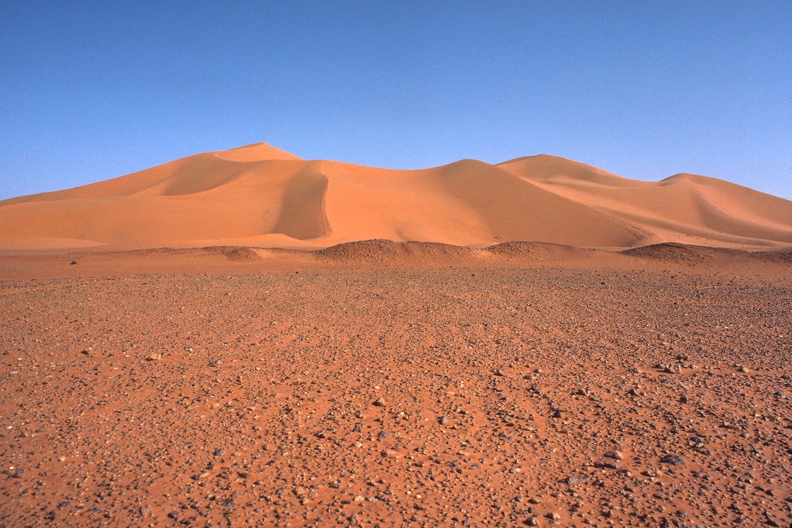
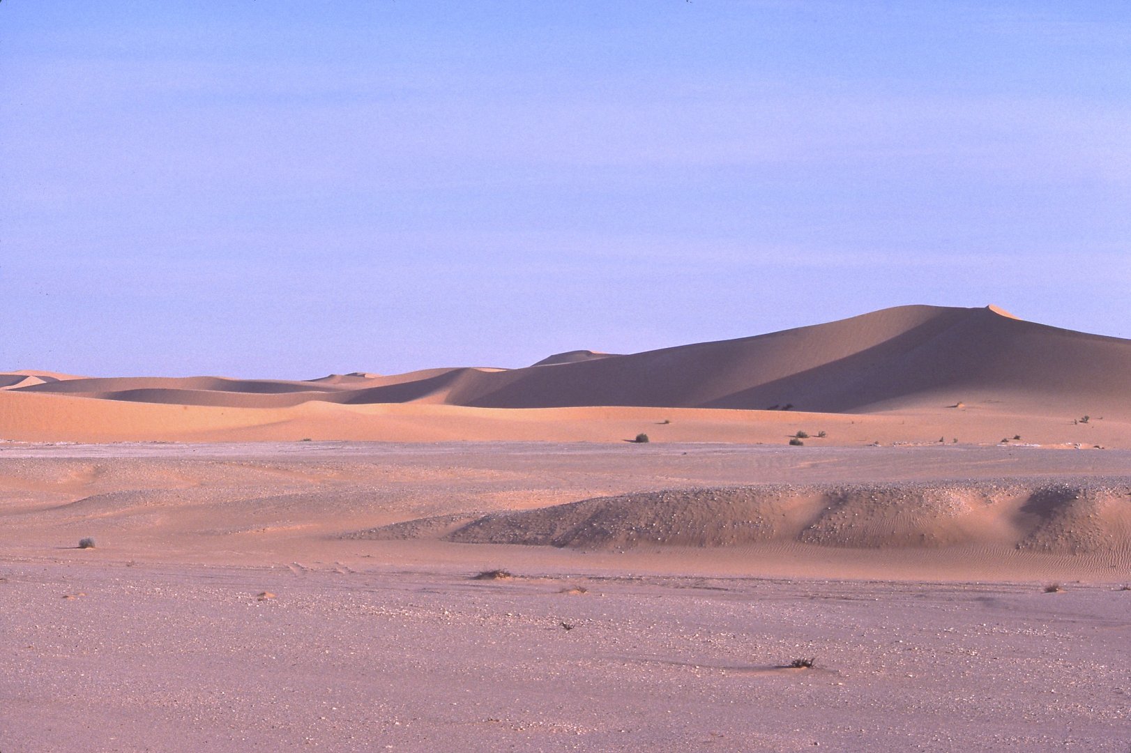
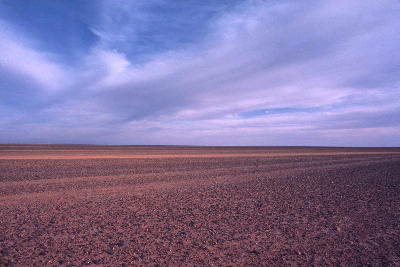
| 013. However, the greater bulk of the Sahara is occupied not by sand dunes but by featureless plains covered in small stones, from which the sand has been blown away. Surfaces like these are termed reg in the Western Sahara and serir in the east. (North of In Amenas) |
 |
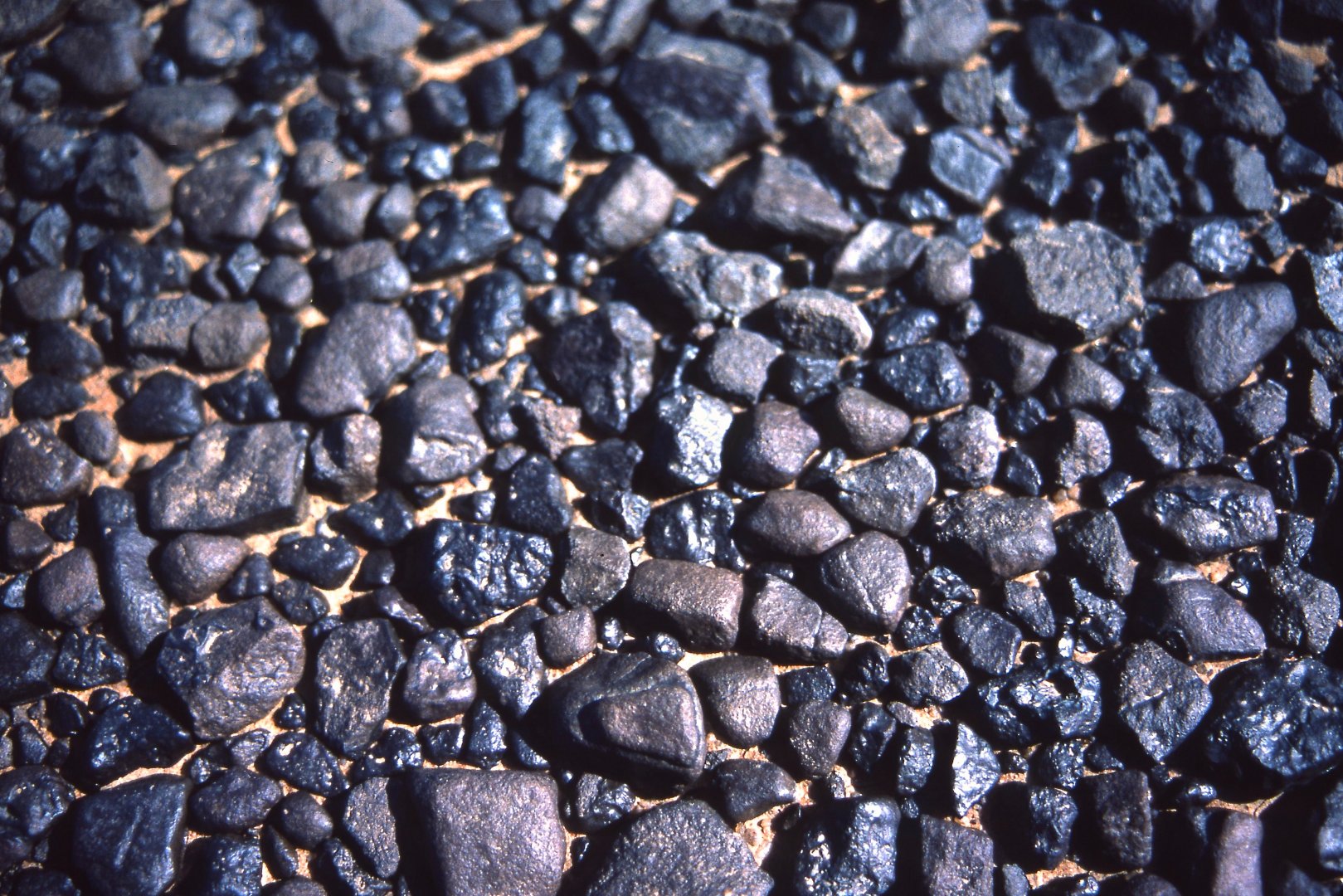
| 014. Since none of the intermittent streams that flow here after rain actually leave the region, the Sahara is covered by the waste products of weathering and erosion. Across flat areas the wind develops its full force, and moves pebbles as well as sand, sorting them according to size. (Edge of Hoggar massif near Ideles) |
 |
| 015. The plateau north of In Salah is named appropriately, in the language of the local Tuareg, Tademait, meaning naked as the palm of a hand -- for you wont see a blade of grass here for hundreds of kilometres. (Plateau du Tademait) |
 |
| 016. In places, too, the surface of the reg may be covered by a desert varnish of iron and manganese oxides, brought to the surface by capillary action and deposited following the evaporation of soil moisture. (Tassili-n-Ajjer) |
 |
| 017. Elsewhere you will find wind-scoured rocky plateaux -- hammada -- flattened by the work of water in times past, and polished later by wind abrasion. (Near Arak; between In Salah and Tamanrasset) |
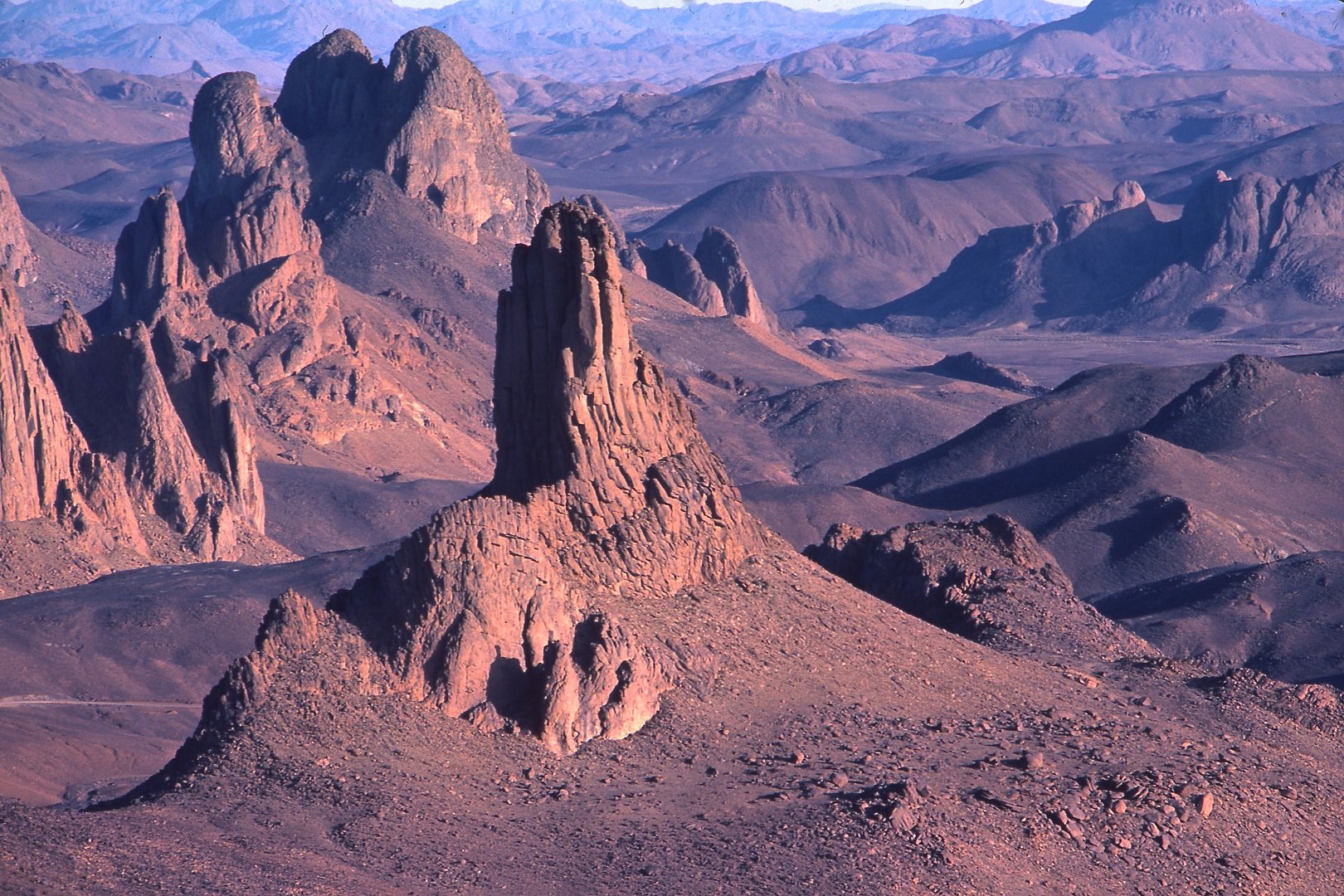 |
| 018. And the centre of the desert is actually mountainous. In southern Algeria the Ahaggar Mountains, also known as the Hoggar, rise to heights in excess of 3,000 metres. (The Assekrem highlands of the Hoggar) |
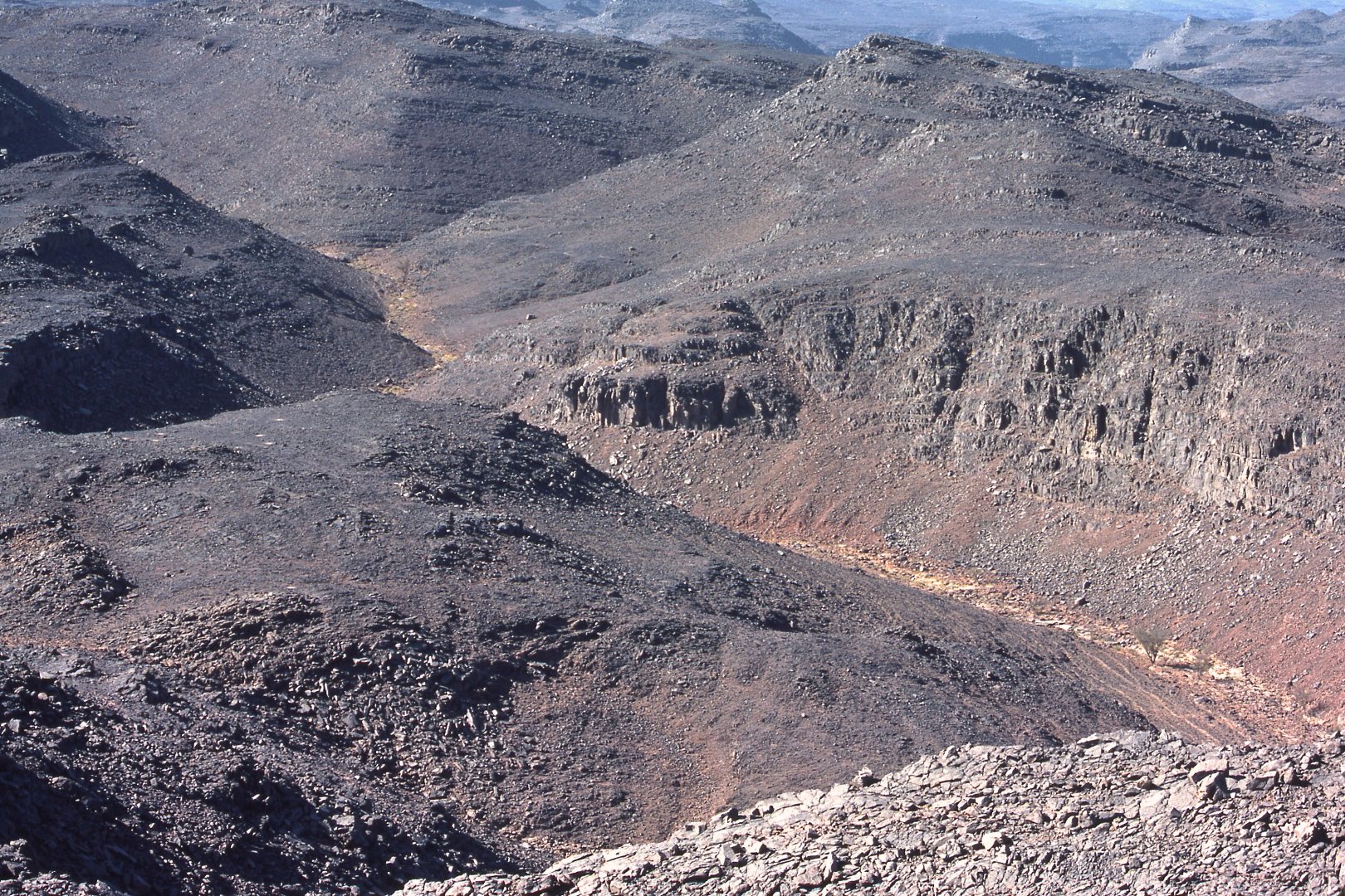 |
| 019. The surface of the mountainous heart of the Sahara is dissected by dry river channels (wadis), for the streams which drain these slopes flow only intermittently, after rain. (Tassili-n-Ajjer between Illizi and Serouenout) |
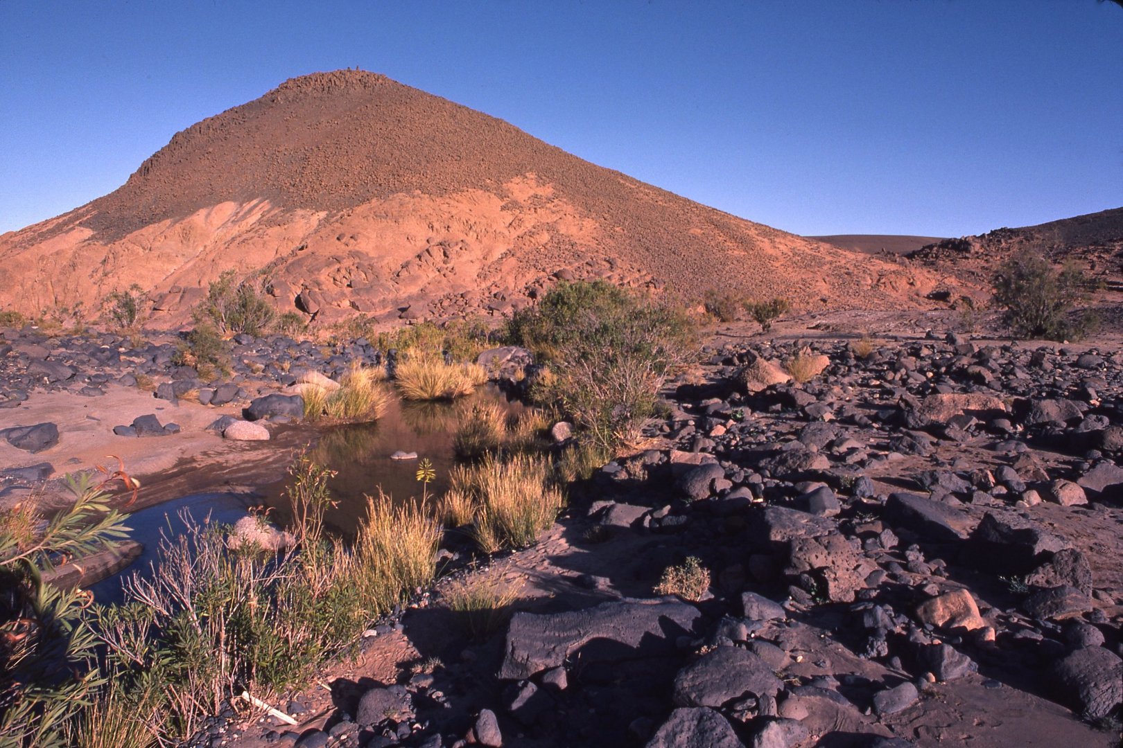 |
| 020. You sometimes find pools of water even in the Sahara, but they do not last long. There are no perennial streams here, for obvious reasons. The Nile only flows year-round because it is nourished by well-watered lands to the south, far beyond the boundaries of the desert. (Hoggar Massif south of Ideles) |
![]()
Text and photos by John Tyman
unless otherwise indicated.
Intended for Educational Use
Only.
Contact Dr. John Tyman at johntyman2@gmail.com
for more information regarding
licensing.
![]()
www.hillmanweb.com
Photo processing, Web page layout,
formatting and hosting by
William
Hillman ~ Brandon, Manitoba ~ Canada
